
bullmoose falls
The Bullmoose Falls trail is a short trail that leads to a beautiful free falling waterfall, with some cascading falls below. This is an excellent trip to add on at the end of a day spent in the Cowmoose Mountain, Holzworth Meadows, Windfall Lake or Pinnacle Peak areas. It is also a popular snowshoe and ice climbing destination in winter.
Distance | Time:
1 km return | 1-2 hours
Trail Rating:
Moderate
(mandatory creek crossing)

Features:
Cascading waterfall.
Caution:
Mandatory creek crossing which is impassible with high water.
-

Trails
To reach Bullmoose Falls, follow the flagged route from the parking area down a grassy slope and across Bullmoose Creek. Keep in mind that the creek can be swift and dangerous at high water levels, so it's advisable to bring a hiking pole or walking stick for the crossing. Water levels typically range from mid-calf to mid-thigh from July to October. The trail then ascends on the left side of the creek and leads through the forest to the falls viewpoint.
-

Trip Link
The short trek to Bullmoose Falls is a great way to end a day of exploring the Cowmoose Mountain, Holzworth Meadows, Windfall Lake or Pinnacle Peak areas.
-

Snowshoeing
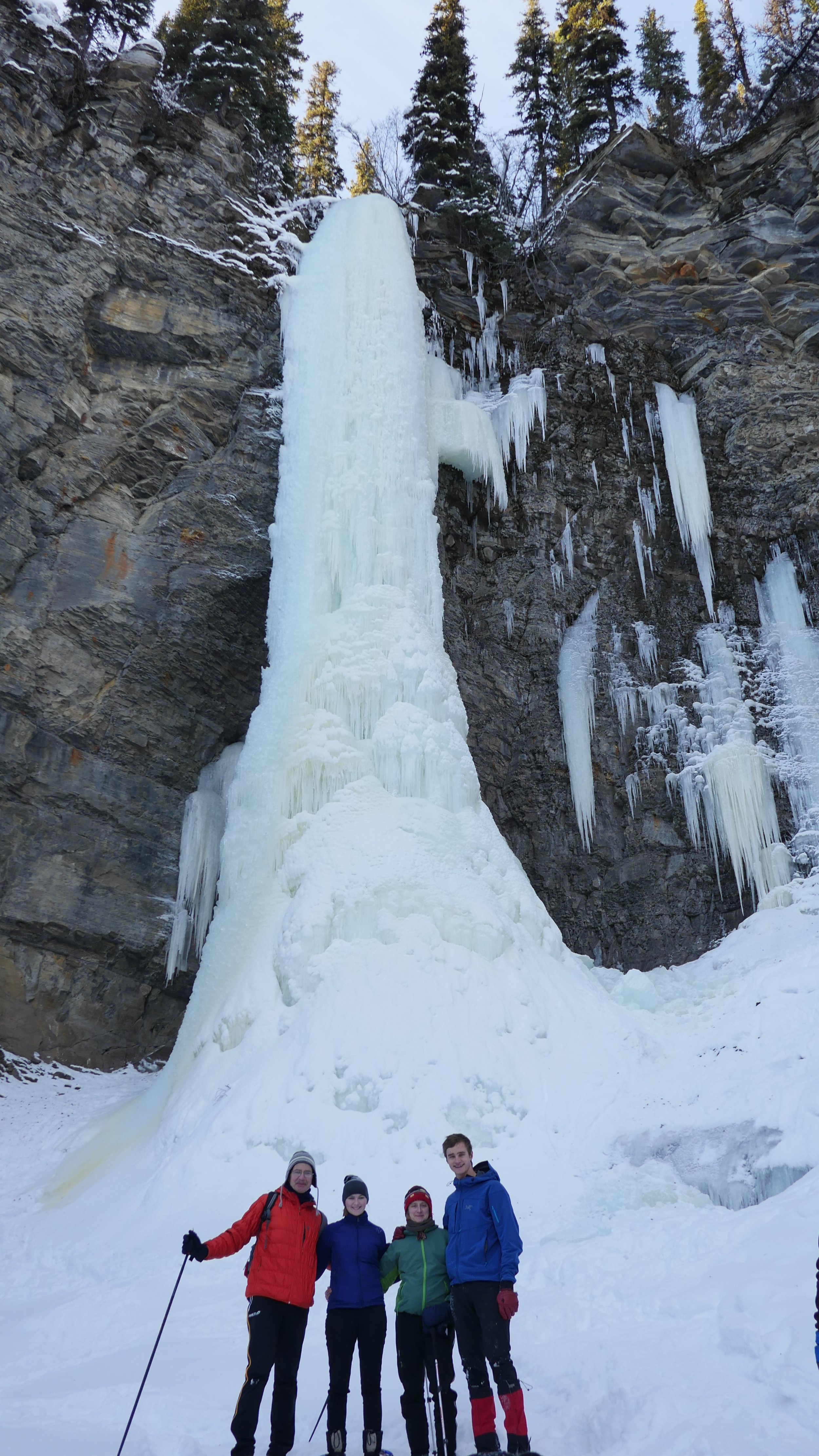
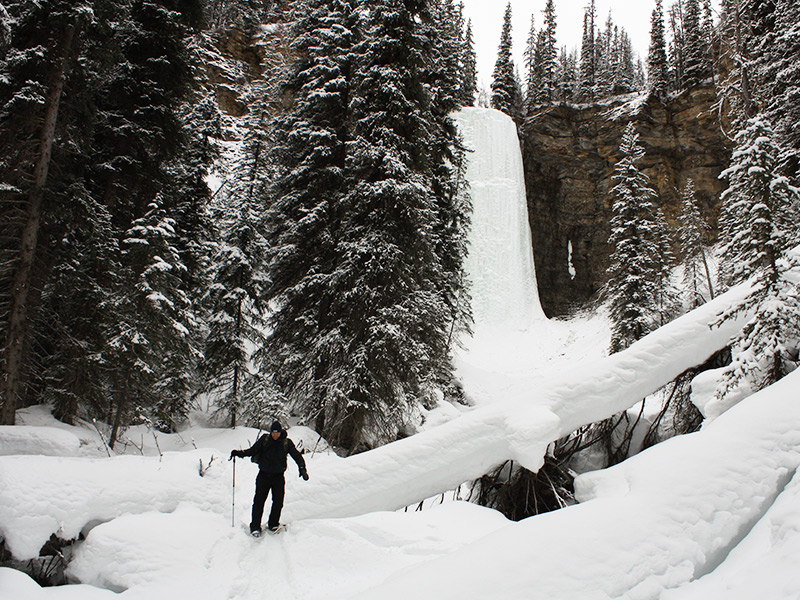
Park on the side of the road where the plowed road ends. Snowshoe along the road, turning right and following the gravel road for another 1 km, where you will see the top of Bullmoose Falls on your right. Following the trail markers and orange flagging tape or existing snowshoe trail, continue less than 1 km to the base of the falls. You will cross a shallow creek on the way that does not freeze in winter, and will likely get your snowshoes and/or boots wet. The route climbs uphill to the base of the falls, which are nearly vertical.
-

Ice Climbing
Amongst the most challenging in the area, Bullmoose Falls is 45 m of absolutely sheer, rock-solid vertical ice, described as having “evil truck-sized gargoyles, brittle chandeliers, buttery blue slab and frosted cauliflowers”. Conditions vary, depending on the day, and can be a “vertical cakewalk” or “unstable, uninsurable and climbed by pure levitation”. BC Peace Region Climbers is a good resource for climbing information.
-

Geology
The rocks here are part of the Gates Formation of Cretaceous age. The hard sandstone that forms the lip of the falls was deposited in a beach environment, along the shore of an inland sea known as the Western Interior Seaway.
-

Caution
Summer: Use extreme caution if you venture close to the falls, as the water is cold and the rocks are very slippery. The mandatory creek crossing will be impassible at high water.
Winter: Use extreme caution when approaching the frozen falls, as large chunks of ice can fall off at any time. This bowl is also prone to avalanches.
DIRECTIONS TO TRAILHEAD
From Tumbler Ridge, drive north towards Chetwynd on Highway 29 for 25 km to the turnoff for the former Bullmoose Mine. Follow the Bullmoose Mine Road for 19 km where the pavement ends at the reclaimed mine site. Drive 1 km along the gravel road to the trailhead sign on the right side. You will see the very top section of the falls. Park along the side of the road here, just before the top of the hill.

thank you to our partners

experience tumbler ridge unfiltered. tag #tumblerridge to show us your adventures.