holzworth meadows
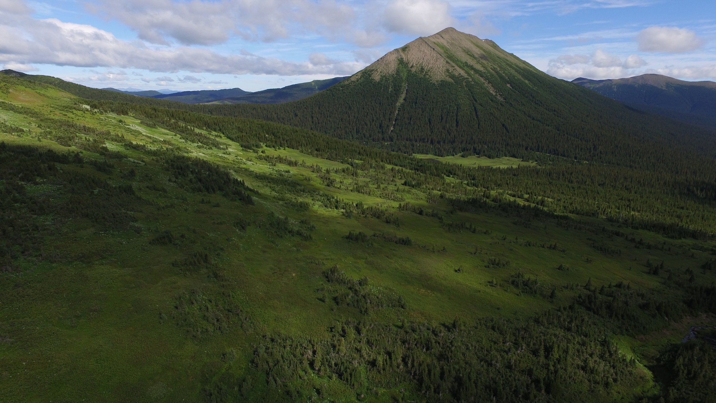
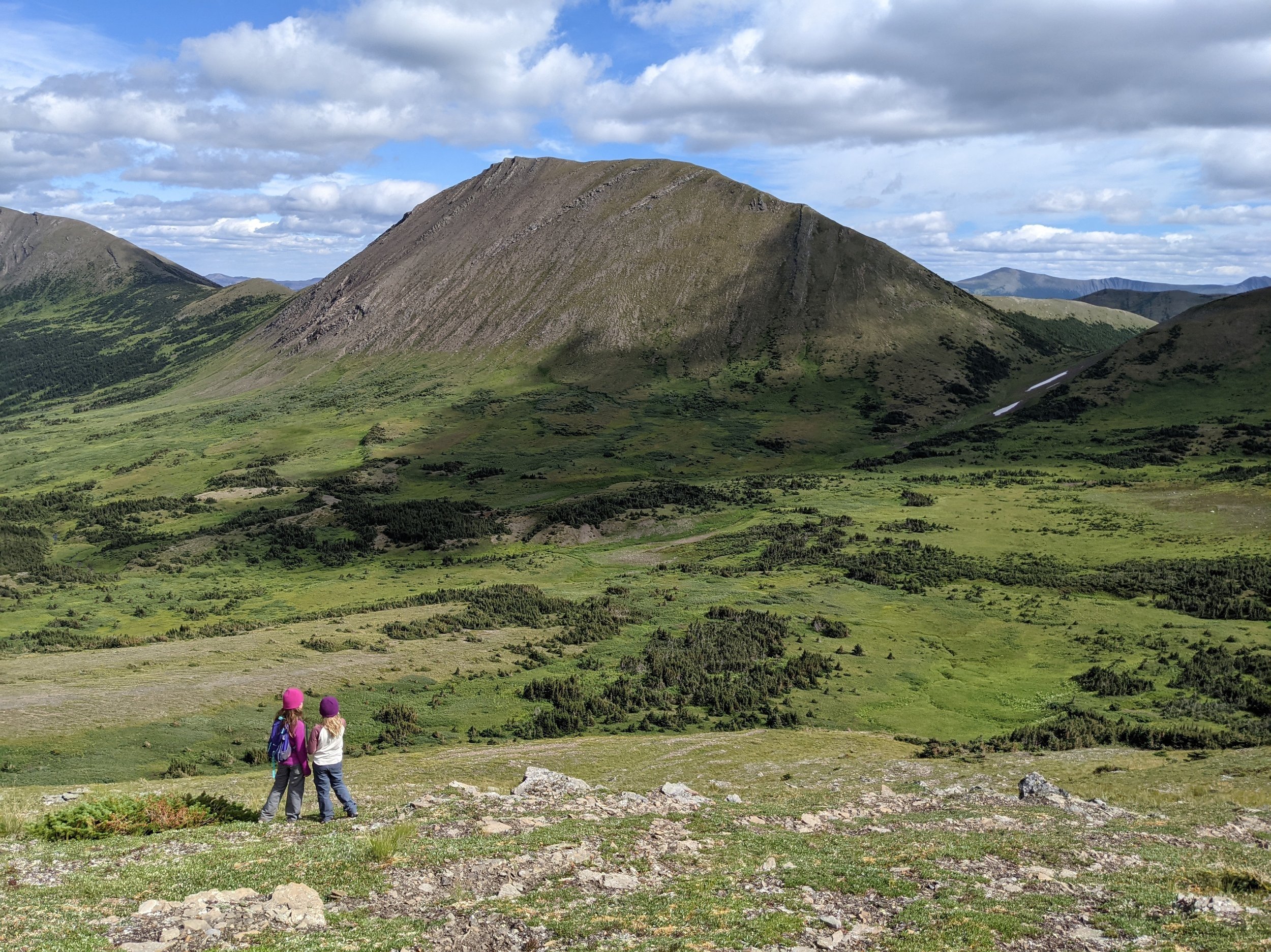
The Holzworth Meadows route leads hikers through a bowl of subalpine meadows onto an alpine ridge, followed by the opportunity for rambling up a series of alpine summits. There are expansive views of the surrounding mountain ranges. Mount Crum to the northwest, with a large anticline on its slopes, and Sentinel Peak to the west, with a glacier on its eastern flank, dominate the skyline.
Distance | Time:
8 km return (main circuit) | 4-6 hours
Elevation Gain: 610 m
Trail Rating:
Challenging

Features:
Alpine meadows and ridges, accessible alpine summits, wildflowers.
-

Trails
There is a large sign at the trailhead. Follow the cutline, which makes a reasonable trail with a few wet sections. After about 500 m following the cutline, the route leaves the trees, and views of the meadows and ridges open up.
The easiest way onto the ridges is to continue on the cutline, which becomes fainter once in the meadows. The first part of the meadow section is fairly marshy. Head up the cutline another 500 m and look for the sign and flagged route onto the ridge to the right. The flagged route follows flower-filled subalpine meadows. Lupines and paintbrush provide a colourful backdrop for the steady climb to the ridge. See the Hiker’s Guide for more information.
-

Trip Link
A great trip link to do on the drive back from Holzworth Meadows is Bullmoose Falls. It is a minor detour on the drive, and short hike to a gorgeous waterfall.
-

Guided Tours
Holzworth Meadows is a challenging hike. It is not a developed trail, but rather a route. It is only suitable for experienced hikers with good route finding skills. Consider checking with our local tour operators to see if they are offering a guided/group hike.
-

Birding
The Holzworth Meadows route provides the opportunity to spot two species of ptarmigan, both of which breed in the area. The Willow Ptarmigan, slightly larger in size, can usually be found in the lush subalpine meadows, while the White-tailed Ptarmigan prefers the highest and most exposed terrain on the ridge tops and summits.
Identifiable by their white outer tail feathers, the White-tailed Ptarmigan is perfectly camouflaged throughout the year. However, it's important to be cautious while hiking, especially during peak season when these birds are raising their young and may be prone to scurrying away rather than flying off.
-

History
Holzworth Meadows is named after John Holzworth, an American explorer who passed through the area on a 1923 expedition to study the distribution of mountain sheep and caribou in northern B.C. He camped at the small lake visible at the foot of Ptarmigan Ridge. Theropod Peak got its name due to the discovery of a theropod dinosaur footprint in the area in 2003. The peaks surrounding the meadows are made up of sandstones and siltstones of the Early Cretaceous age Minnes Group and are approximately 140 million years old.
-

Caution
These are not developed trails but rather routes. They are only suitable for experienced hikers with good route-finding skills.
Alpine weather can change suddenly, Windy and foggy conditions can occur without warning. Carry appropriate clothing and a GPS.
This route is in bear country; travel in groups and make noise.
DIRECTIONS TO TRAILHEAD
From Tumbler Ridge, drive north towards Chetwynd on Hwy 29 for 25 km to the turnoff for the former Bullmoose Mine. Follow the Bullmoose Mine Rd for 17 km and turn left onto the Windfall Creek Forest Service Road. This turnoff is just before an electrical substation.
Follow the Windfall Creek FSR as it heads up the valley of South Bullmoose Creek. There is a junction at the 9 km mark – do not take the turnoff to the left; instead head straight, cross a small bridge, and continue up the road. At km 13.2, there is a sign showing parking on the right side of the road. The trailhead is 200 m further up the road.

thank you to our partners


experience tumbler ridge unfiltered. tag #tumblerridge to show us your adventures.