tumbler point
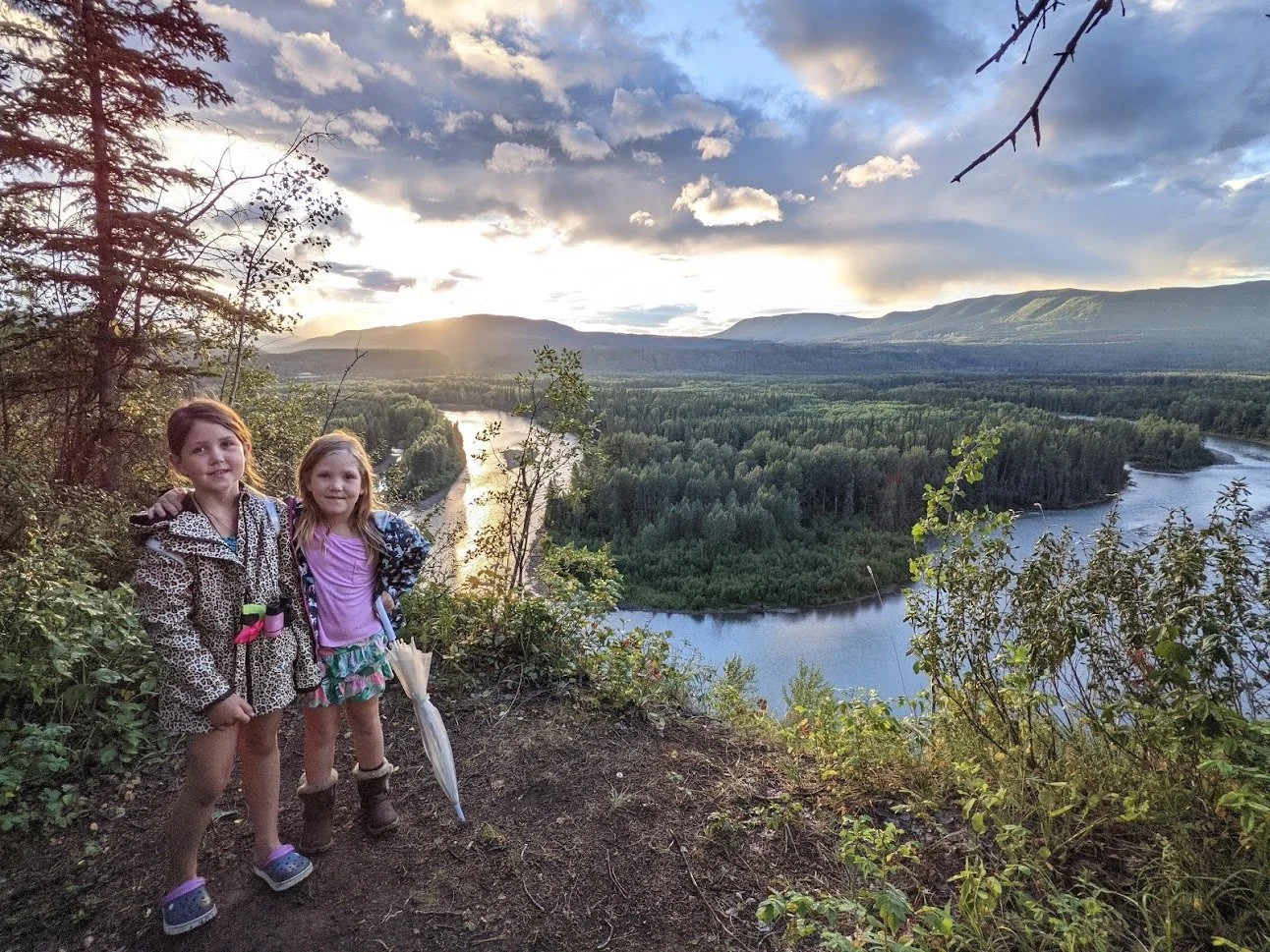
The trail to Tumbler Point is on the west side of Tumbler Ridge, and is a great walk along the escarpment above Flatbed Creek. The trail follows along the edge of an escarpment, with expansive views of the Murray River valley. The area is a bird sanctuary, with 89 types of birds recorded so far. The Tumbler Point trail forms part of the 28-kilometer-long TR Trail, which encircles three quarters of the community of Tumbler Ridge, and there are signs along the trail to indicate this.
Distance | Time:
4 km return | 1 - 2 hours
Trail Rating:
Easy

Features:
Easy trail close to Tumbler Ridge, views, bird sanctuary.
Caution:
Trail runs on edge of escarpment in places.
-

Trails
The Tumbler Point trail is an easy 4 km return trip. From the parking area, look for a sign on the near side of a drainage ditch. This is the start of the access to the trail. At 0.7 km, a junction is reached. The right branch leads to the golf course. Continue left along the escarpment to reach Tumbler Point. A few hundred metres further, the trail reaches another junction which is the start of the loop to the point. This can be followed either clockwise or counterclockwise. The quickest way to the point is to take the left fork, staying on the escarpment. Continue around the loop, joining the main trail in 1 km. Then you can retrace your steps back to the start, or take the branch that leads to the golf course.
-

Trip Link
Tumbler Point trail is part of the 28 km TR Trail that encircles three quarters of Tumbler Ridge without crossing a single paved road. Spur trails lead to waterfalls, rock formations, dinosaur tracks, picnic areas, river and creek-side portions, natural swimming pools, spectacular view-sites, and a backcountry cabin. The trail also passes the Lions Campground and the Golf Course.
-

Geology
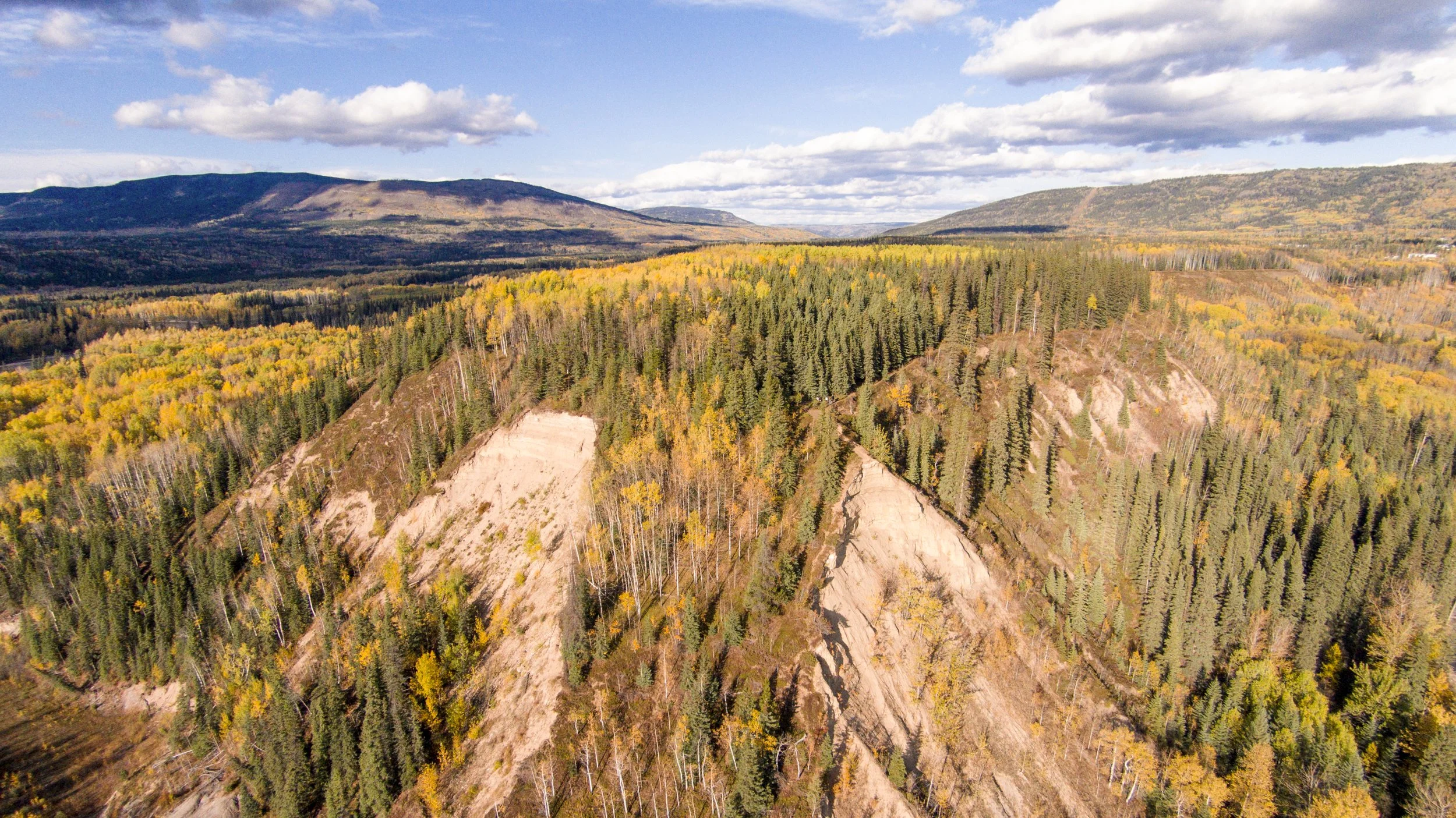
Once at the point itself, there is a good view up and down the Murray River valley. During the last ice age, the Murray River valley was blocked by ice downstream, backing up the water into a lake that occupied the whole valley. The point itself is actually a remnant of a terrace formed by sediment deposits from this lake. Use caution when walking out on the end of the point, as it is made up of an unstable sand cliff.
-

Birds
The large sign located at the trail entrance provides information about the diverse range of bird species that can be observed along the path. This particular trail is highly recommended for birdwatching enthusiasts due to its passage through various types of forests and open slopes, offering excellent vistas of the forest canopy. It presents an opportunity to encounter both eastern and western bird species, often found at the edges of their geographical ranges. For optimal birdwatching experiences, particularly during the spring season, early morning hours are ideal.
-

Biking
The closest biking trail to the town site is Tumbler Point, which is a technical single track trail that leads through mixed forest to an escarpment. This escarpment is above the Flatbed Creek valley, and then the Murray River valley, offering excellent views.
-

Caution
Use caution at the edge of the escarpment.
DIRECTIONS TO TRAILHEAD
The main starting point for the Tumbler Point trail is the end of Bergeron Drive, on the lower section of town. From the town center, take Bergeron Drive and follow it to its end. There is parking available at the end of the road. Many other informal trails also lead to the Tumbler Point trail.

thank you to our partners

experience tumbler ridge unfiltered. tag #tumblerridge to show us your adventures.