
mount reesor
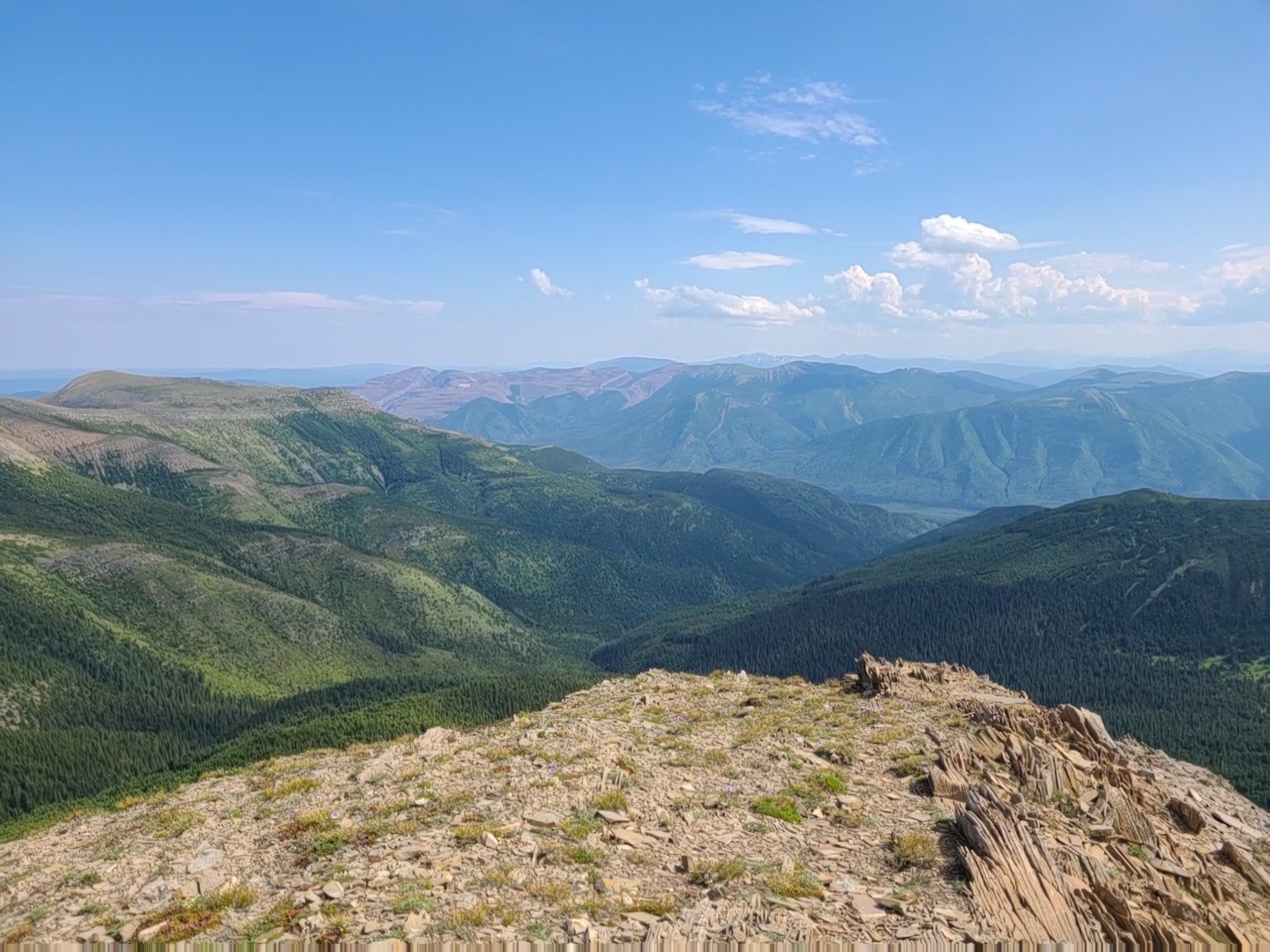
The Mount Reesor area offers fantastic opportunities for alpine hiking near Tumbler Ridge. En route to Mount Reesor, an exceptional attraction awaits atop the ridge - an expanse of barren brown shale, known as the Caribou Highway.
Distance | Time:
10 km return | 5-6 hours
Elevation Gain: 560 m
Trail Rating:
Challenging

Features:
Alpine summit.
-

Trails
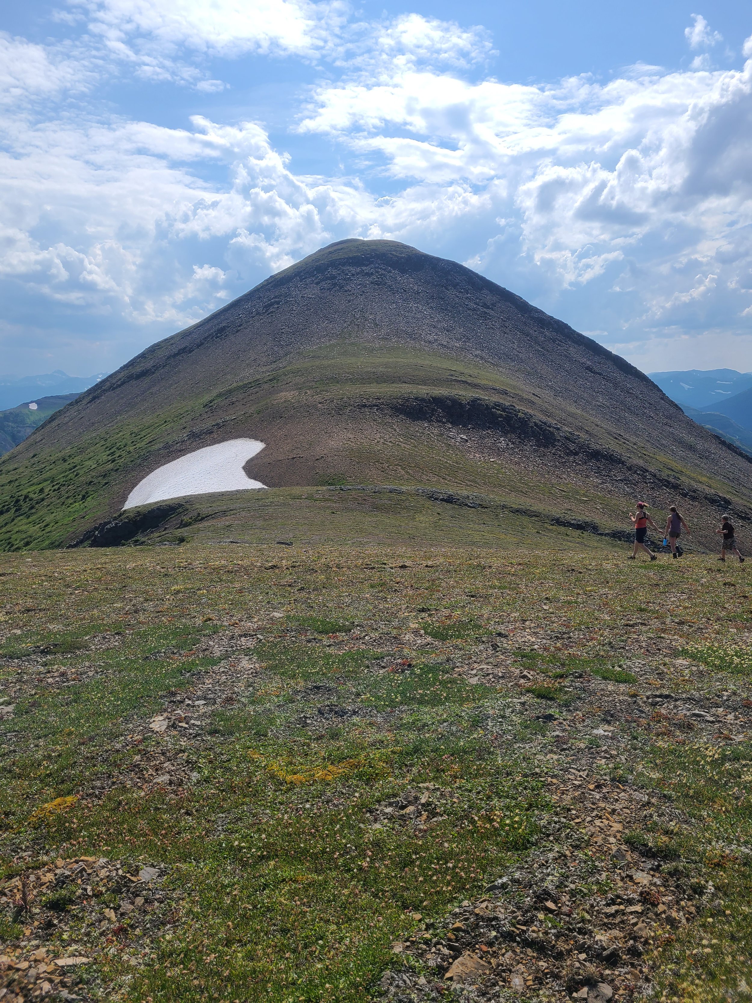
The hike begins at the northwest edge of the clearing. Follow the pipeline's western path for a few hundred meters and watch for a sign and flagging on the left. The flagged route leads up to the tree line along the ridge. Once you reach the ridge's summit, you'll be treated to magnificent views towards the south and west. The ridge itself is a barren expanse of brown shale called the Caribou Highway, occasionally revealing animal tracks and signs. The Caribou Highway continues southward, leading towards Mount Reesor in the distance. After completing the Caribou Highway, descend to the saddle before commencing the final ascent to the peak. See the WNMS Hiker’s Guide for more information.
-

Trip Link
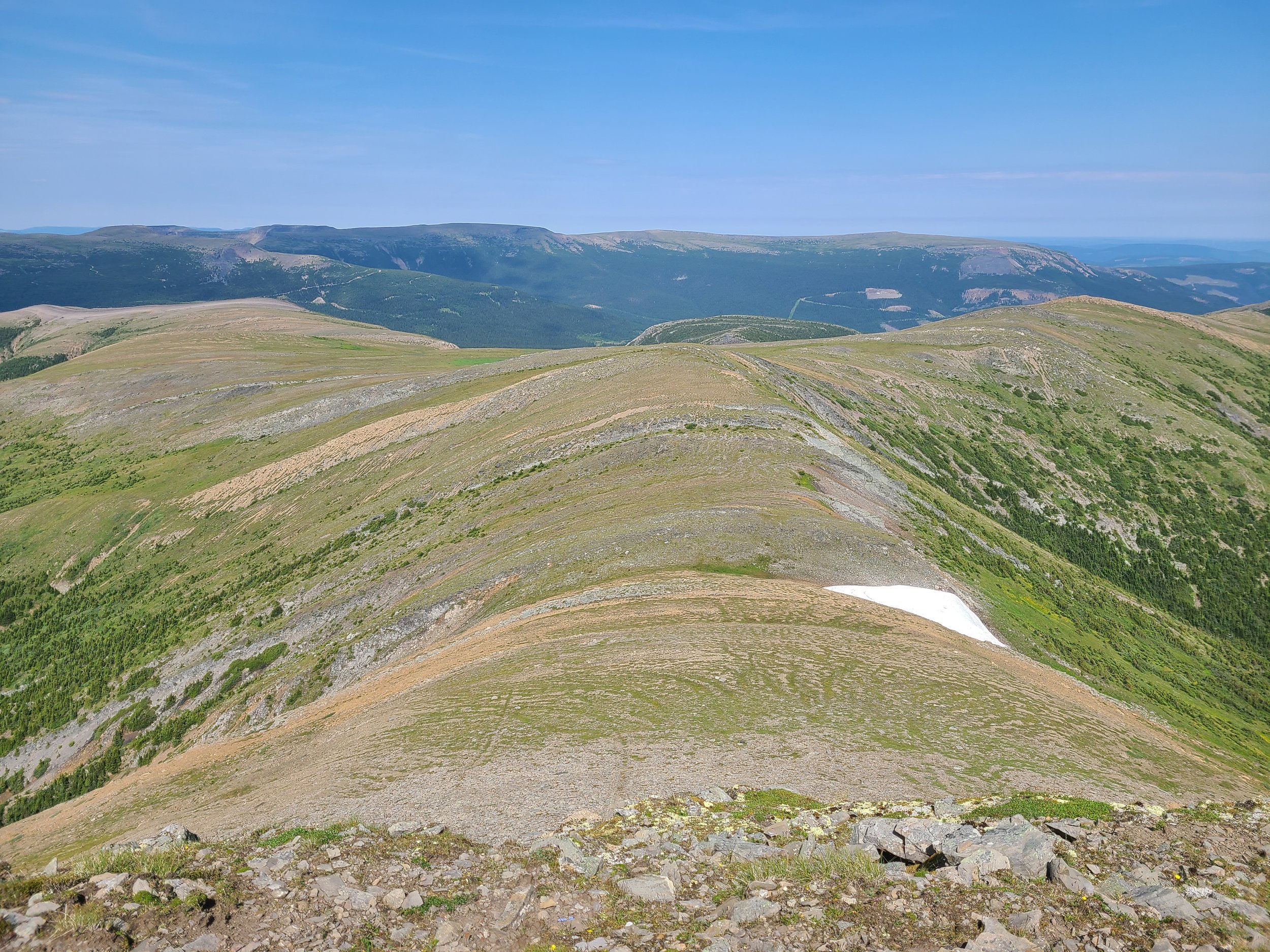
For those seeking to extend their ridgewalking adventure, the return journey offers an opportunity to continue along the eastern side of the ridge, leading towards two additional summits. This section provides a spacious alpine environment, allowing you to meander through open spaces while marveling at the sight of steeply dipping bedding planes and slabs. As you reach the far end of this area, you'll encounter a vast plateau shaped by a gentle syncline. Here, coarse-grained sandstone and conglomerate slabs are prominently displayed on each side, providing a captivating visual experience. Keep in mind that the best way down is to follow the Caribou Highway back instead of shortcutting to the road.
-

Guided Tours
Mount Reesor is a challenging hike with a 560 m elevation gain. Once you reach the alpine, it is beneficial to have route-finding skills. Check with our local guides as they may have options available to do a guided and/or group hike.
-

Wildlife
Caribou, marmot and ptarmigan are often seen in this area, with the possibility of Golden Eagles overhead, and grizzly bear and wolf in the krummholz and alpine zones.
-

Geology
Explore the captivating geological wonders of the Mt. Reesor hiking area as you traverse a diverse range of Lower Cretaceous rock formations. Embark on the main route, which takes you over sandstone bedrock and onto the ridge, offering an enchanting ascent. Over the next kilometer, you'll experience the awe-inspiring "Caribou Highway" along the ridge-top. Immerse yourself in a breathtaking desert-like landscape, where barren brown shales dominate the scene, allowing only minimal plant growth at this altitude.
-

Caution
These are not developed trails, but rather routes. They are only suitable for experienced hikers with good route-finding skills. Windy and foggy conditions can occur without warning. Be aware of industrial traffic on the access road. This route is in bear country; travel in groups and make noise. Please pack out what you packed in.
DIRECTIONS TO TRAILHEAD
From Tumbler Ridge, drive north towards Chetwynd on Hwy 29 for 8.8 km to the turnoff for the Wolverine Forest Service Road. This is a radio controlled road and there is industrial traffic from the Wolverine Mine as well as possible logging trucks. A radio is strongly recommended. Zero your odometer. Turn right onto the Perry Creek Rd at km 12.2.
Follow the Perry Creek Rd as it heads up the valley past the mine. There are junctions at the 10.2 km and 12 km marks – take the right fork at the first one and the left fork at the second one. The final junction is at 13.7 km. Take the left fork at this one, crossing a bridge, and follow the road about 3 km to its end at a large clearing (the right fork leads to a gas well and the start of the Mount Spieker hiking routes).


thank you to our partners

experience tumbler ridge unfiltered. tag #tumblerridge to show us your adventures.