
TR TRAIL
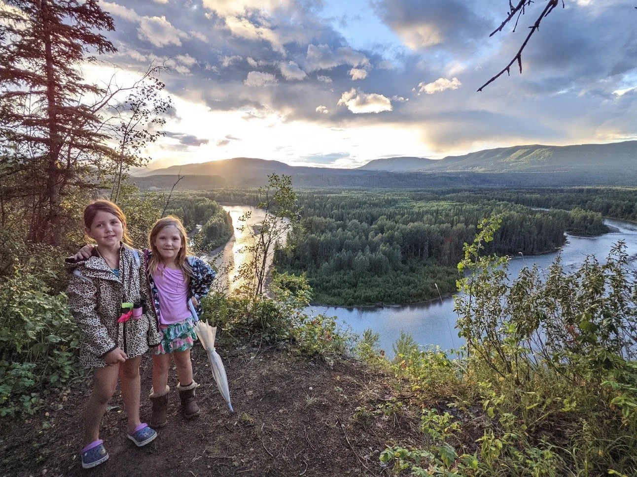
The TR TRAIL, spanning 27 km, encircles three quarters of Tumbler Ridge without necessitating the crossing of any paved roads. Along the trail, spurs guide you to waterfalls, rock formations, dinosaur tracks, picnic areas, and creek-side spots, natural swimming pools, breathtaking viewpoints, and a secluded backcountry cabin. It traverses through the Lions Flatbed Creek Campground and the Golf Course restaurant, providing a comprehensive tour of the distinctive sites at Tumbler Ridge's doorstep that collectively contribute to the uniqueness of this community.
Distance | Time:
up to 28 km | 1 - 7 hours
Trail Rating:
Moderate to Challenging


Features:
Waterfalls, rock formations, dinosaur tracks, picnic areas, riverine and creek-side spots, natural swimming pools, breathtaking viewpoints, and a secluded backcountry cabin.
Caution:
Please pack your garbage out. Travel in groups and carry bear spray.
-

Trails
The TR Trail consists of 4 legs.
Leg 1 - Trailhead to Flatbed parking lot spans 7 kilometres. The first 3 km follow Kevin’s Trail, the next 4 km leads you along flatbed creek to Top Pool, Oysterbeds, Overhanging Rock Pool and Flatbed falls.
Leg 2 - Flatbed Falls parking lot to Lions Campground parking lot spans 5 km. You will pass by McManus bench, Mini Falls, and Bridge Pool.
Leg 3 - Lions Campground to Golf Course parking lot spans 5.5 km. Passing Murray River viewpoint and Nathan’s Trail.
Leg 4 - Golf course to Ball Diamonds is 10 kms long. Views include Bergeron Cliffs, the Murray River, and Lost Haven Cabin.
-

Geology
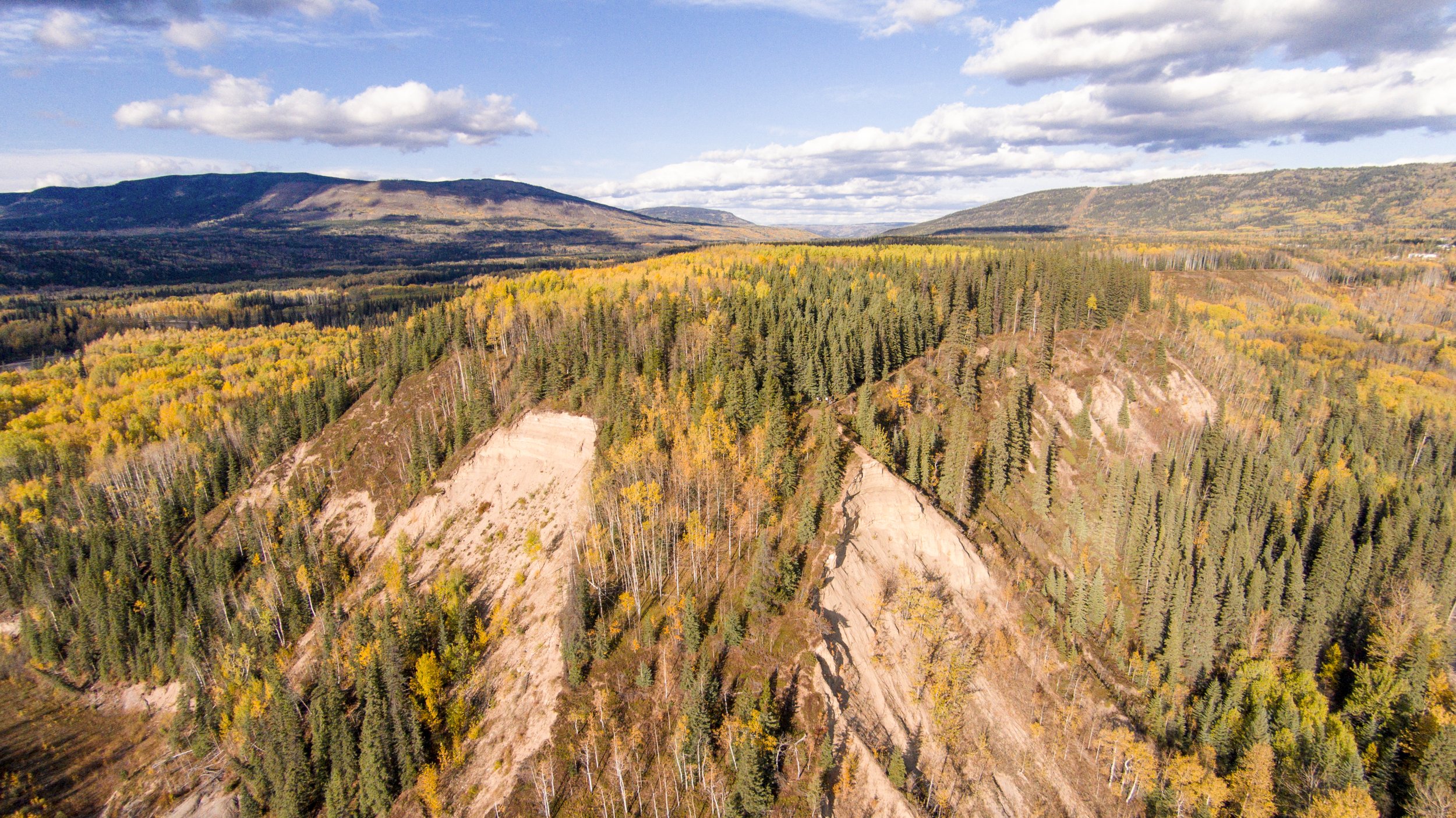
Once at the point itself, there is a good view up and down the Murray River valley. During the last ice age, the Murray River valley was blocked by ice downstream, backing up the water into a lake that occupied the whole valley. The point itself is actually a remnant of a terrace formed by sediment deposits from this lake. Use caution when walking out on the end of the point, as it is made up of an unstable sand cliff.
-

Caution
A few parts of the TR Trail are steep, and work is ongoing to improve these through steps and hand-lines. In a few places it passes above steep dropoffs – caution signs warn trail users of these hazards. Pine-beetle infestation has led to many dead pine trees, so avoid hiking in very windy conditions as the risk of falling trees is greatest at these times. In the longer term, it is planned to extend the trail to form a complete circuit around Tumbler Ridge, which will include the spur trail up to the Bald Spot.
DIRECTIONS TO TRAILHEAD
There are five signposted access points to the TR Trail: at the start beside Hwy 52 E near the Gun Club, the Flatbed Falls parking lot, Lion’s Flatbed Creek Campground parking lot, Golf Course parking lot, and at the back of the ball diamonds behind backstop #3. These conveniently break the total distance into four legs.

thank you to our partners

experience tumbler ridge unfiltered. tag #tumblerridge to show us your adventures.