murray canyon overlook
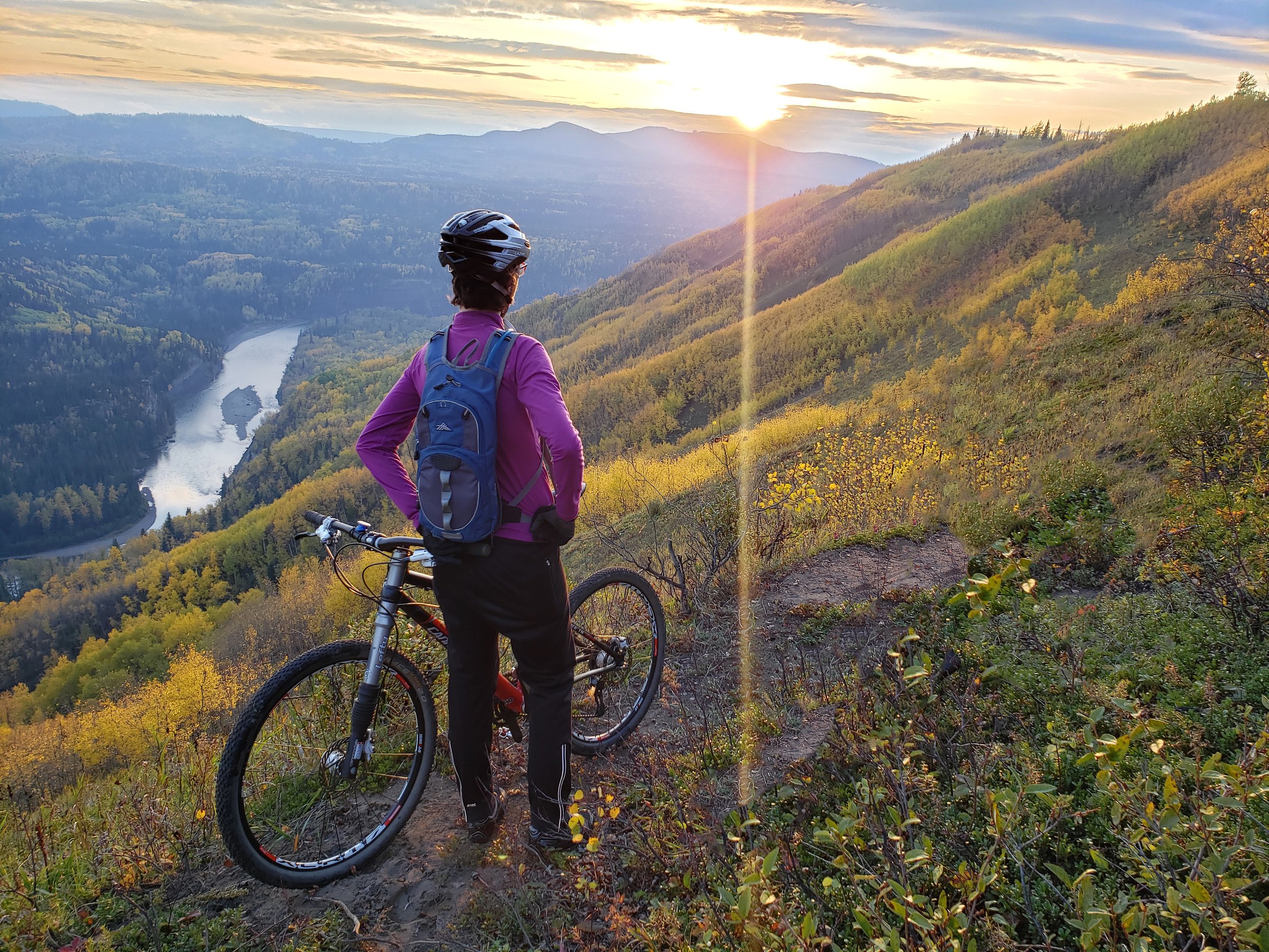
The Murray Canyon Overlook trail winds through lush forests that lead to breathtaking hillsides, towering over 300 meters above the Murray River basin. Popular with hikers, runners and mountain bikers, the trail features scenic viewpoints and benches, offering an immersive experience of the Murray River Valley's topography.
Distance | Time:
6.5 km return | 2 hours
Trail Rating:
Easy

Features:
Views of river valley and canyon, interpretive brochure.
-

Trails
The first half of the trail leads through a cut block that was harvested by the Tumbler Ridge Community Forest. The original trail was built in 2000, and started at this same location. In 2013 the area around the first part of the trail was harvested, and WNMS moved the trailhead to a different location. In 2022, that access was blocked by a gravel pit, so the trailhead was moved back to the original location.
The first 250 m is on the original trail, after which it follows an old logging road. After 1 km, the trail leaves the logging road and once again joins the original trail. At 1.75 km it suddenly emerges onto the edge of the Murray River Valley, where a rustic staircase leads to a bench where you can admire the magnificent view. From here the trail traverses along the rim of the valley for 1.5 km along an improved old game trail, with the river flowing over 300 m below, cutting an attractive canyon. The trail is mostly flat from here to the turnaround point, with wonderful views all around.
-

Geology
Immerse yourself in a landscape shaped by the forces of ice. You are walking on glacial till, and in occasional places where the trail is sandy, this sand was deposited by wind at the edge of the glacier. During the Pleistocene Era, an immense ice sheet extended southwest, reaching the prairies, while another colossal ice mass advanced northeast from the Rockies. In the wake of a warming climate, vast quantities of meltwater surged through the region, converging against the formidable ice wall to create Glacial Lake Peace. Along its shores, mammoths, camels, bison, and horses roamed. The lake's levels experienced fluctuation, as nature's rhythm played out in its repetitive rise and fall.
-

Birds & Wildlife
A total of 93 bird species have been identified. Nesting boxes and bird feeders have been put up alongside the trails. Bullmoose Marshes is a sensitive bird nesting area. Hatching season is April to June.
Mammals include Grizzly Bear, Black Bear, Moose, White-tailed Deer, Mule Deer, Wolf, Coyote, Woodchuck, Red Squirrel, Red-backed Vole, Beaver, and Muskrat. There are many signs of beaver activity including dams, trails, felled trees and lodges.
-

Wind Energy
The often windy conditions of this area also explain the wind turbines, visible in the distance, of Capital Power’s Quality Wind Project. This was one of the first wind energy projects developed in British Columbia. Quality Wind is located on approximately 4,250 acres of provincial Crown Land near Tumbler Ridge in northeastern British Columbia. Power generated at the facility is sold to BC Hydro under a 25-year Energy Purchase Agreement.
-

Biking
Seeking a change of pace? If you're not in the mood for walking today, why not hop on your bike and explore the exhilarating Murray Canyon Overlook Trail? This trail is a perfect choice for mountain bikers, offering a thrilling experience on a technical single track. As you navigate the trail, be prepared for breathtaking river views that will leave you in awe.
-

Caution
The second half of the trail is exposed and often windy. Travel in groups and carry bear spray. Please pack out what you pack in.
DIRECTIONS TO TRAILHEAD
From Tumbler Ridge, drive 30 km north on Hwy 52 towards Dawson Creek. The trailhead and parking are in a highway pullout on the left. The trailhead itself is at the south (Tumbler Ridge) end of the pullout.
From Dawson Creek, drive west on Hwy 97 towards Chetwynd. After 18 km turn south (left) onto Hwy 52 towards Tumbler Ridge. Drive 70 km on this highway, and the trailhead and parking are in a highway pullout on the right.


thank you to our partners

experience tumbler ridge unfiltered. tag #tumblerridge to show us your adventures.