
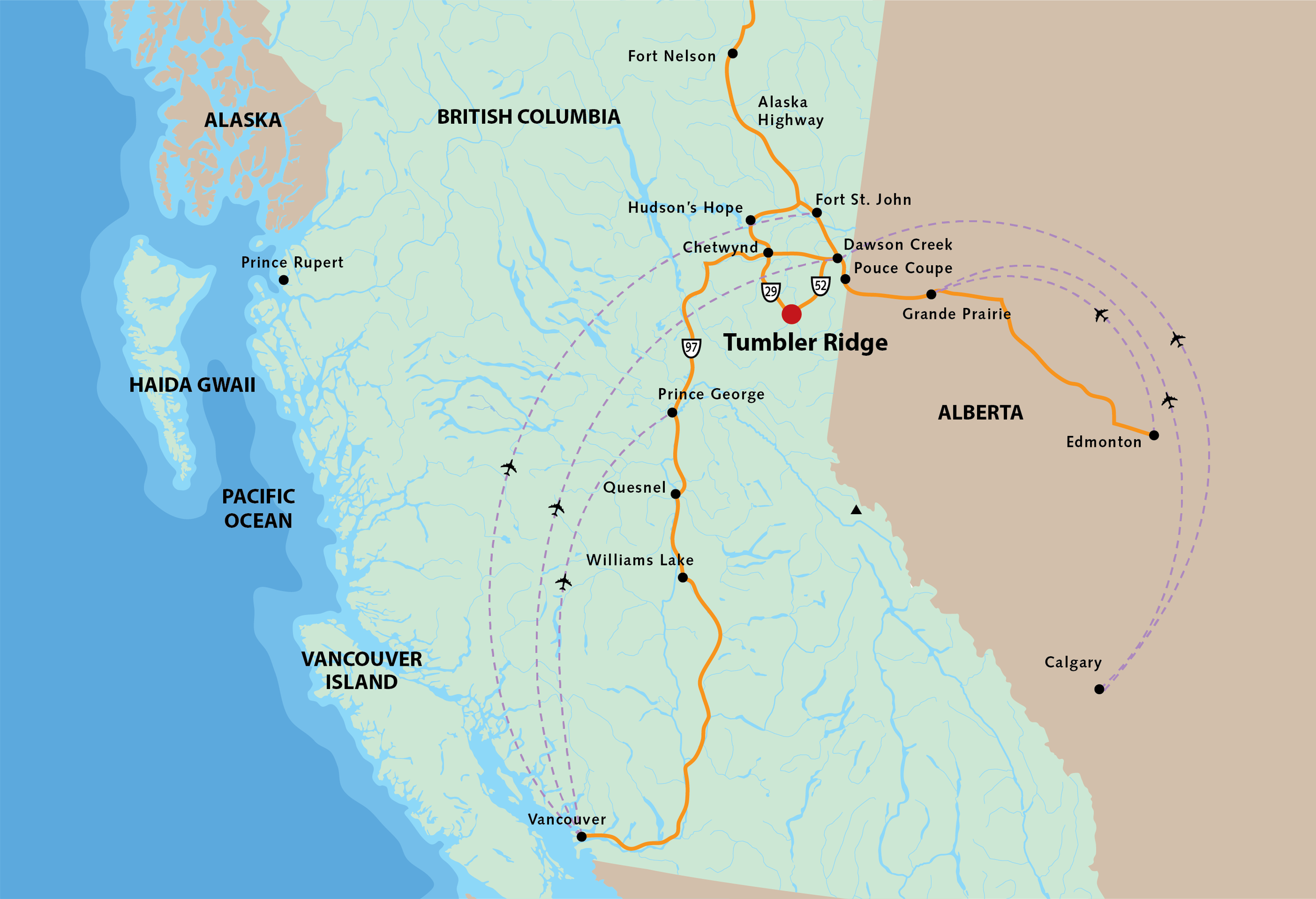
GETTING HERE
Tumbler Ridge may be surrounded by wilderness, but it is also very accessible.
Located in the foothills of the Rocky Mountains, just 117 kilometers from Mile “0” of the Alaska Highway in Dawson Creek, Tumbler Ridge sits in the heart of a recreation lover’s paradise.
By Road
Be sure to consider the season and the weather when planning your trip. If you are planning a winter visit, please visit DriveBC before venturing out, as road conditions can be less than ideal and can also change quickly.
Road access is on Highway 52 from Dawson Creek and Highway 29 from Chetwynd.
Please be aware that if you take the shortest route on your GPS, you could end up on a Forest Service Road – which is often not a good idea if you’re driving a car as not all FSRs are well maintained (especially during winter months). Stick to Hwy 29W and/or 52N. Be mindful of 52E (from Alberta), this route is partially gravelled as well.
By Air
There is regularly scheduled air service into Dawson Creek, Fort St. John, Prince George and Grande Prairie, Alberta, that brings visitors from cities across Canada and the US.
Other Info
There is currently no bus or shuttle service available to and from Tumbler Ridge. There are also no vehicle rental services in Tumbler Ridge, so if you are planning to fly and rent a vehicle, you will need to do so in the larger centers.
Distance to Tumbler Ridge from:
Chetwynd 92km 55 Miles
Dawson Creek 117km 72 Miles
Hudson’s Hope 155km 96 Miles
Fort St. John 188km 117 Miles
Grande Prairie, AB 250km 155 Miles
Prince George 400km 249 Miles
Edmonton, AB 702km 436 Miles
Calgary, AB 1000km 621 Miles
Vancouver 1186km 737 Miles